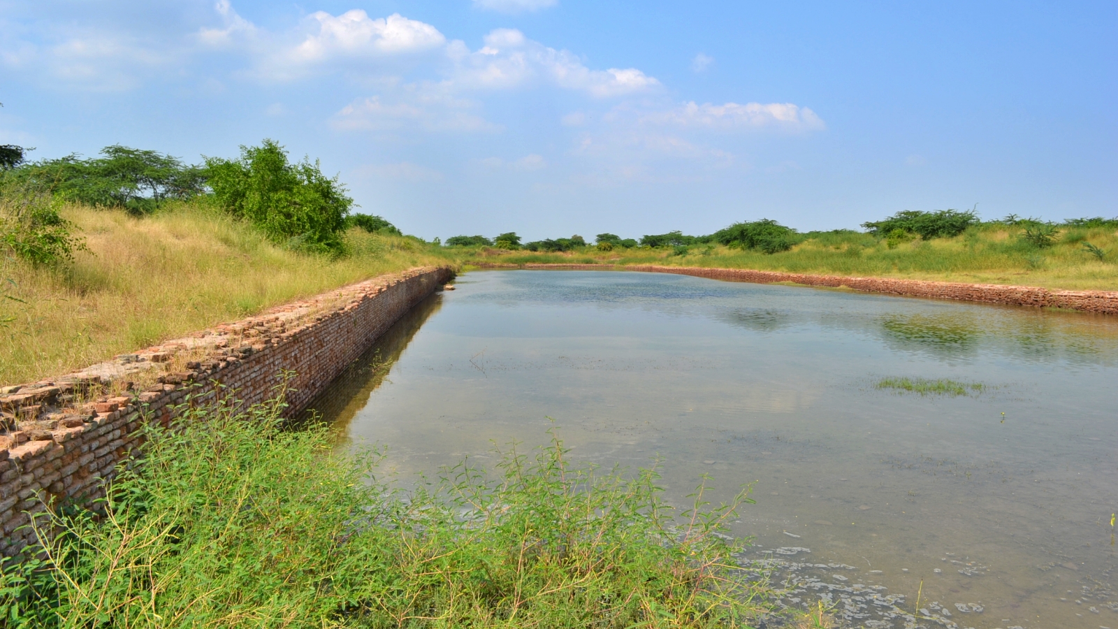
Recently, researchers from IIT Gandhinagar uncovered fresh evidence that supports the existence of a dock in Lothal, one of the most important Harappan sites in India.
Since Lothal was first discovered in 1954, archaeologists have debated whether the roughly 215-m long and 37-m wide structure, excavated at the township’s eastern edge, was a dockyard. ASI has always supported the dockyard thesis, but some scholars have argued that its size and inlet suggest more mundane usage. Here is the story of Lothal, and its “dock”.
National identity is forged at the altar of history, a shared past acting as the glue that makes a “people”. This is why the discovery of the Indus Valley Civilisation in 1924, which pushed back the history of India by more than 1,000 years, was a seminal moment for the nation. The sophistication of sites like Mohenjodaro and Harappa was a matter of pride for Indians, long seen as backward by colonial masters.
Unfortunately, this ancient civilisation was among the many casualties of Partition. With almost all known sites located around the Indus, suddenly, the civilisation Indians had proudly claimed as their own lay on the other side of the border. This sent ASI scampering for new sites in India. The 1950s saw a flurry of archaeological activity. Among the many sites discovered, Lothal was the most significant. The site was excavated between 1955 and 1962.
Lothal, among southernmost Harappan sites, lies 80 km southwest of Ahmedabad, at the head of the Gulf of Khambhat. In Gujarati, “Lothal” loosely translates to the “place of the dead” — a name given by villagers who knew of the existence of an ancient settlement (and remains of the long dead) much before the site’s official discovery.
The Lothal excavations were led by S R Rao, among the finest Indian archaeologists of his generation who discovered over 30 Harappan sites. It is he who identified the excavated Lothal structure as a dockyard.
“The largest structure of baked bricks ever constructed by the Harappans is the one laid bare at Lothal… to serve as a dock for berthing ships and handling cargo,” he wrote in Penn Museum’s Expedition Magazine in 1965. “Originally, the dock was designed to sluice ships 18 m to 20 m in length and 4 m to 6 m in width… At least two ships could pass through the inlet simultaneously,” he added.
Other evidence that Lothal served as a hub for maritime commerce came from the presence of seals — more than in any other site in Kathiawar/Saurashtra — that were likely used to seal documents or mark packages, discovery of various items that were likely traded, a warehouse, and what Rao referred to as stone anchors for ships.
But not everyone was convinced. In 1968, anthropologist Lawrence S Leshnik posited the “port” was actually a reservoir for drinking water and irrigating crops. He held that the dimensions of the inlet for ships to dock were inadequate to support the draught (hull) of seafaring vessels. As was the depth of the “dock”. He also questioned the inlet’s orientation. “It is not understandable why the inlet should be in such a position that entering ships would have to take a 90 degree turn in order to berth,” he wrote.
The IIT-Gandhinagar study addresses some of these doubts.
Today, the Sabarmati flows into the Gulf of Khambhat about 20 km from Lothal. The ASI has long believed that the river used to run much closer to the Harappan town at some point.
Satellite imagery used by IIT-Gandhinagar researchers has “unveiled the old channels of river Sabarmati”, which used to flow right next to Lothal. The river gradually shifted its course, leaving the ruins of Lothal’s dockyard with a seemingly odd orientation. The study found that via the Sabarmati, boats could have sailed to as far as Dholavira, another important Harappan site in the Rann of Kutch.
This, the study said, put Lothal at the heart of a bustling trade network that stretched from India all the way to ancient Mesopotamia (modern-day Iraq), where the earliest Bronze Age civilisation flourished.
This is what Rao had theorised half a century ago: “Inhabitants exported agricultural and marine products and imported raw materials such as gemstones and metals, needed for domestic consumption and for supplying the processing industries which sustained a large population.”
Just like water brought Lothal prosperity as a commercial port, it also ushered in destruction.
Lothal’s archaeological record indicates its settlements were rebuilt multiple times. Rao identified five distinct phases in the site’s stratigraphic record dated circa 2400-1900 BCE. At its peak, late 3rd millennium BCE, Lothal may have been home to 15,000 people.
The decline, and eventual destruction of Lothal, occurred due to catastrophic flooding, and the Sabarmati changing course. As Rao noted in Lothal: A Harappan Port Town (1979), circa 2000 BCE, Lothal was submerged in a catastrophic flood — the acropolis was levelled and flood debris and silt destroyed buildings. Although people remained on site, the settlement was reduced to “an ill-planned village lacking essential civic amenities”. Another flood destroyed the township for good circa 1900 BCE.


